Sunday, August 16, 2009

Goodbye Yellowstone!

This morning, Colin and I finished packing up the cars and I said my final goodbyes to my friends at the dorm before starting our long road trip back to Florida. We stopped in Gardiner on the way to get some breakfast at Town Cafe and take some pictures. 


Gardiner, MT

Me in front of the Roosevelt Arch

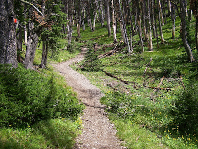
Heading out of Gardiner

We drove to Livingston and picked up 90 East towards Billings. At Crow Agency, we took route 212 East. Just after turning on to 212, we stopped at Little Bighorn Battlefield National Monument. Thanks, Obama, for making this a fee free weekend in the parks! We spent a couple of hours there at the museum and battlefield site learning about one of the defining moments of American history. We walked up to Last Stand Hill, where Custer along with dozens of others were killed. The places where people died are marked with white stone markers. Custer's marker is black. 

Custer's Black Marker

Last Stand Hill


We also took the interpretive drive and followed the exhibit panels on the way back that explained the chronology of events of the battle and pointed out important places. I am glad I got to see this place that I have read so much about. 

From Little Bighorn, we continued East on 212, along the hilly one lane country road. After about 200 miles, we entered Wyoming and then soon after reached South Dakota. At Belle Fourche, SD, we took 85 South to Spearfish, where we called it a night. Tomorrow we hope to make it to Omaha, NE. 

Saturday, August 15, 2009

Bliss Pass

Today Colin, Charlotte, and I hiked to Bliss Pass, a 15 mile out and back.  The trail begins at the Pebble Creek Trailhead. We got an early start, leaving the dorm at 7:30 and began hiking before 9 AM. The weather was chilly when we began, at about 45 degrees. 

The trail began its initial 1200 foot climb immediately. The climb brought us up and over a mountain ridge and down into a gorgeous valley on the other side.  

A nice view from the climb at the start of the hike


Hiking down into the meadow

We hiked across the flat valley for several miles. We forded Pebble Creek once and crossed it a few other times before entering a short section of burned forest. At the 5.5 mile mark, we took the two mile spur trail to Bliss Pass. 


Several hundred yards into the spur trail, we had to ford Pebble Creek once again. Afterwards, the trail started switchbacking steeply towards Bliss Pass. We enjoyed views of magnificent mountains in every direction on the hike up to Bliss Pass. While the mountains around us were very rocky and dramatic, Bliss Pass itself was a lovely, grassy spot between two mountains. We enjoyed our lunch and then took a short nap before heading back down to the trailhead. 


Pebble Creek 

A lovely view as we switchbacked up to Bliss Pass

Charlotte and me at Bliss Pass


As I am leaving Yellowstone tomorrow for school, this was a fantastic capstone hike. I will be very sorry to leave such an amazing place, but feel very lucky to have spent a summer here. I have made some wonderful friends and seen some incredible sights. I am very happy to say that I will be back next summer to complete my project in lieu of thesis at the Heritage and Research Center where I worked this summer. My project will be to make a disaster management plan for the museum collection. Already, I can't wait to come back to this place! 

Monday, August 10, 2009

Wolf Watching

Tonight after work, Colin and I headed to the Lamar Valley in the Northeast section of the park to look for wolves. I hadn't seen any wolves all summer, and really wanted to before I leave at the end of the week. We arrived in the Lamar Valley at around 7:30 PM and there were already several big groups of people out there with their big scopes searching the valley for wolves.

Lamar Valley


We just had a pair of binoculars, but they worked pretty well. At first, we just saw a large herd of buffalo, but then we started picking out other animals, including antelope, a coyote picking at a carcass, and several pronghorn. Some people with scopes said they could see wolves way in the distance, but we couldn't see them in the binoculars because they were too far away. We headed further down the road to try and get a better vantage point. There we were able to spot a group of three wolves far off in the valley, which was really neat! We also spotted more pronghorn, buffalo, and antelope.


As the sun set, our visibility diminished and we finally decided to call it a night. It was neat to see the wolves, but it was also great to observe all the other wildlife out in nthe valley.

Sunday, August 9, 2009

Elephant Back Mountain and Avalanche Peak

This morning, Colin and I got up early and drove to the Lake Yellowstone area in the Southern section of the park to hike Elephant Back Mountain and Avalanche Peak. Both hikes are exactly 4 miles and are out and back hikes. We hiked Elephant Back first. 

Elephant back is a gradual, 800 ft. climb to a beautiful view of Yellowstone Lake. It was about 40 degrees when we started hiking, but we warmed up quickly as we climbed. The trail went through lush, green forest until the summit. Towards the top, we got some beautiful views of the lake below. From the top, we could see the Lake Hotel, the oldest hotel in the park, built in the late 1800s. After taking in the views at the top, we headed down to the trailhead so we could start our second hike of the day. 

The trail up Elephant Back Mountain


At the top

Lake Yellowstone below


The trailhead to Avalanche Peak is about 19 miles away from the trailhead to Elephant Back. We got there at around noon, and started the strenuous hike to the summit. The entire hike up is a category H climb. Interestingly, H stands for "horrible" and I could certainly see why on this hike. 

Although the hike up was only 2 miles, it seemed like 4. The first 1.2 miles are through the woods. Finally, we came to the tree line, and the terrain changed immediately. The forest was replaced with rocks - covering the entire mountain and the trail up, which was covered in skree. The trail went along the edge of the exposed mountainside, and the wind was so strong and cold that it took my breath away at times. 


The treeline

The summit in the distance


We continued up to an open area that we thought was the summit. We soon realized that we were wrong - the summit was in front of us and still a big climb awaited us. We continued on the trail, which was now made up of red rocks. 


At the summit


When we got to the top, we were rewarded with amazing views in all directions which made all our effort worth it. It was extremely cold and windy on the tiny, rocky summit. We stayed long enough to take some pictures and enjoy the view before heading back to the trailhead. The trail was so steep that my knees were very sore by the time we got to the bottom. The amazing views were definitely worth it though!

Saturday, August 8, 2009

Pebble Creek

Today Colin and I hiked the Pebble Creek Trail, a 12 mile shuttle near the northeast entrance of the park. The trail began climbing immediately and continued to do so for the first two miles of the hike. Green grass and bright wildflowers grew among the trees through which we hiked. At the top of the climb, we had a fantastic view of the mountains surrounding us.

The beginning of the hike


Meadows along the way


Enjoying the nice view at the top of the climb

We continued on, through several meadows and small sections of forest. After about 4 miles, we came to the first of four river fords along the hike. At this point, we noticed a cold wind blowing and dark clouds behind us. We wondered whether we should turn around or keep going. We finally decided to keep going, because the sky in front of us was much brighter and we did not hear any thunder. 

One of four times we forded windy Pebble Creek

After fording the river, we entered a burned section of forest. The trail followed alongside the river until we came to the second river ford. After that, we continued through burned forest for a few more miles. After hiking about 6 miles, the terrain opened up, and we got amazing views of the dramatic mountains around us. 

Burned forest

About 6 miles in, we got some great mountain views


We continued on, fording the river again, and finally entered a huge meadow. We saw dark clouds behind us and heard thunder rumbling in the distance. We quickened our pace to get into the woods and out of the open meadow before the storm reached us. When we got to the woods, we climbed up a ridge and then down the other side to the parking lot, about two miles total. We got rained on a little, but for the most part, we were lucky to avoid the storm. 

The storm closing in on us